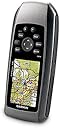
🧭 Float, Navigate, Conquer: The GPS that keeps you ahead on every wave.
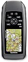
The Garmin GPSMAP 78S is a rugged, waterproof handheld marine GPS navigator featuring a 2.6-inch color TFT display, built-in worldwide basemap, and a high-sensitivity GPS receiver with HotFix™ satellite prediction. It includes a 3-axis electronic compass and barometric altimeter for precise navigation and weather tracking. With 1.7MB internal memory plus a microSD slot, users can expand maps and satellite imagery. Designed to float and withstand marine conditions, it supports wireless sharing of waypoints and routes, and integrates with Garmin Connect for activity analysis and social sharing.

| ASIN | B003I86PJ6 |
| Additional Features | Rugged case, Garmin HotFix, Photo navigation, Barometric altimeter, Garmin Connect compatible, Electromagnetic compass, Custom POIs, Automatic routing, Hunt/fish calendar, Geocaching |
| Battery Average Life | 20 hours |
| Best Sellers Rank | #114,501 in Electronics ( See Top 100 in Electronics ) #63 in Marine GPS Units & Chartplotters |
| Brand | Garmin |
| Built-In Media | Garmin 010-00864-01 Garmin Gpsmap 78S Handheld |
| Compatible Devices | Smartphone |
| Compatible Flash Memory Type | microSD |
| Compatible with Vehicle Type | Boat |
| Connectivity Protocol | GPSmap |
| Connectivity Technology | gpsmap |
| Control Method | Touch |
| Customer Reviews | 4.4 out of 5 stars 503 Reviews |
| Display Type | LCD |
| Global Trade Identification Number | 00753759986773 |
| Human-Interface Input | Buttons |
| Item Dimensions L x W x H | 1.2"L x 2.6"W x 6"H |
| Item Type Name | Handheld Marine GPS Navigator and World Wide Chartplotter |
| Item Weight | 218.3 g |
| Manufacturer | Garmin |
| Map Types | Worldwide |
| Memory Storage Capacity | 1724 MB |
| Mfr Part Number | 010-00864-01 |
| Model Name | Garmin |
| Model Number | 010-00864-01 |
| Model Year | 2010 |
| Mounting Type | Dashboard Mount, found in image |
| Number of Items | 1 |
| Resolution | 160 x 240 |
| Screen Size | 4 inches |
| Special Feature | Rugged case, Garmin HotFix, Photo navigation, Barometric altimeter, Garmin Connect compatible, Electromagnetic compass, Custom POIs, Automatic routing, Hunt/fish calendar, Geocaching Special Feature Rugged case, Garmin HotFix, Photo navigation, Barometric altimeter, Garmin Connect compatible, Electromagnetic compass, Custom POIs, Automatic routing, Hunt/fish calendar, Geocaching See more |
| Sport Type | Fishing |
| Supported Satellite Navigation System | GPS |
| Touch Screen Type | Resistive |
| UPC | 115971002936 617407543087 014891448803 753759121662 097367187581 796793398072 753759100919 753759986773 031112534152 |
| Unit Count | 1 Count |
| Vehicle Service Type | Boat |
| Warranty Description | 1-year limited parts and labor |
R**B
A remarkable navigation tool
I read the reviews before purchase and must say that I do not agree with the grouse regarding operating the device. OK it is not all intuitive but the instructions are clear and easy to follow. One just needs to learn a few commands to handle everything. I am not planning to test it in water as I do not regard it as waterproof but nice to know just in case. I would like a longer strap so that I can wear it around the neck and maybe tuck it inside a waterproof. If you would like depth reading, you would need to wire it to a transponder. A bit pointless, one might as well have a dedicated instrument. What it does do it does very well. It even has a timer if you are starting a race. Check it at the 5 minute gun and you will have an accurate start. I think that the world map that Garmin uses is rather old and inaccurate! I was puzzled why I left a main road according to the GPS but was indeed on it. Reason - an airport had been build where the road used to be - rather a long time ago!! I hope that the dedicated maps are more accurate.
A**F
Best price performance.
I was using previously one of the older model of this type with black and white screen. When looking for another unit years later it was really easy to make up my mind. Decided to take this as versatile device that would be good both on water and on hike in bad weather. Battery life is great and with my usage patterns they last really long time - three fishing/hiking weekends easy. Unit has great functionality and everything I need is packed there. However as the years go by - one may wish for a bit better display, but that is mostly due to my poor eyesight. I would recommend this unit regardless of the fact that smartphones these days offer perhaps better mapping services, but thy are not reliable while you are away from socket for days and in more challenging conditions.
D**B
4 years and gong strong
I have been using this about about 200 days a year in the field since I got it several years ago. I put a screen protector on it, and change it out once or twice a year. I use this all day everyday for field biology work, navigating 2.4km transects, marking data points, etc. It took some getting used to Basecamp, and I still use Mapsource for some stuff to work with files, but the Garmin software is WAAAY easier than the deLorme stuff. I got a Delorme Earthmate PN-60w for a backup/replacement when my old Garmin 76 got run over, and I found the PN60much to difficult to figure out, and the software was crazy. I got both because fo the ability to download satellite imagery to them. The Delorme software is to tedious, too many layers. Garmin you just say high resolution, and go for it. The Garmin download speeds are SLOW. To get a 150mile by 100 mile area at high res, expect to spend a day and ahalf coming back and clicking on the next section you want download. a 200mb file will take an hour or so. I have tried on faster connections than my 5mb/sec setup, and it is still tediously slow. Pros-Indestructible(mostly) I like the 10000 waypoints, I put a 32gb memory card in there and have about 20gb of satelite imagery downloaded onto it. I like the old style push buttons I go a day and half on my rechargeable AA batteries that I charge on my little solar charger I think you can go 2 days on regular AA's, though I use the screen saver that turns the screen off at 15sec, 30sec, 1 min, or 2 min intervals Pro and con-customizable setup, you can make it look like your old style garmin format for those who are too used the 76, but it is somewhat tedious to do that, and it is a little too easy to accidentally hit reset to factory-that does not erase your data, just your page setups, map setups, etc. Cons-Garmin sat imagery is slow to download, requires their $30 a year subscription service. OH, and, if you have sat imagery on your computer that you downloaded while your subscription was in effect, once it expires, you can't move it back onto your device. They want that $30 a year. Eh, cost of doing business for me, maybe not so appealing to a recreational user.
T**N
Great GPS for Dual-sport use
I chose this "marine" GPS for use on my motorcycle over the 62 because it has the robust 4-pin power connector. The buttons on top aren't terrible - but not ideal either. The unit is quite accurate, even in deep canyons and with thick canopy overhead, I've never had it not know where I am. The screen is clear and quite readable even in bright light. It takes the beating of handlebar mounted desert riding very well. I've crashed on it pretty hard and had it fly out of the RAM mount to find it 15 feet away. I like the power options - being able to grab it off the bike and take it hiking is great - also nice peace of mind that I'll have a GPS if I have to leave the bike due to malfunction. The battery life on 2200mah rechargeables is about 1.5 - 2 days of use. There are a few downsides which made me give it 4 stars. There's no way to make the backlight stay on, can only keep it on for 2 minutes at a time. Annoying since I also use it as my speedometer. The maps are expensive, and you DO have to buy one to get any sort of functionality from it. There are sites that make good, free, routable maps but the Garmin maps are not cheap. The way it breaks up routes and tracks is confusing and unintuitive. And finally - this applies to the base model only - but when you stop, since there is no compass your arrow spins around in a circle instead of staying the direction it was pointed last, making finding your way at intersections difficult at times. I can't possibly see a reason for this except to make you wish you'd ponied up the extra money for the unit with the compass (which I do).
W**Y
Works well on land too (as long as you download maps)
I use one of these units pretty extensively at work for backcountry navigation. The barometer and waterproofing come in quite handy even on land for detecting and dealing with foul weather. Garmin's basemap for land navigation sucks, but topo maps are readily available for download. I got mine free from a non-Garmin website. I outfitted my unit with a 32GB micro-SD card to boost the memory capacity. So far, topographic info for the entire US, Puerto Rico, and most of Canada takes up about 8GB, so you can fit a LOT of information into one of these things if you feel the need to. I've never used any of the marine features or optional Garmin map products, so I'll let someone else speak to those. Overall this is a good unit. I'm quite happy with mine.
D**D
Decent product, but WARNING ABOUT CUSTOM MAPS!
This is a pretty good handheld marine gps unit. I got the 78s because it offered a tri-axial compass, so it is really like a 78sc, but without the built-in charts of the sc it was a couple hundred dollars less. One of the selling points for me, was the ability to upload custom maps to the device. With little effort, one can download all NOAA chart data and use the chart data to make maps for your Garmin. HOWEVER, after purchasing the Garmin 78s, then creating maps and loading maps, I discovered a huge flaw in the device. Custom map files are basically jpgs combined with a data file in a compressed format. The jpgs in the compressed file cannot be bigger than 1024x1024 and Garmin only allows 100 of these jpgs in any compressed file to be loaded in memory at one time. One single NOAA chart will contain 60-100 of these jpg files. Your device has the *storage* capacity for maybe 90 of these compressed map files, but Garmin only allows ~1 of these map files to be loaded into memory at once. Normally, I would say that this is not a big deal, IF THERE WAS AN INTERFACE to unload/load custom map files using the device. Sadly, this is not so. So, the only option is load the NOAA chart you want and when your boat has gone 10 miles, turn off your Garmin 78s, hook it up to a computer, navigate to your Garmin on computer, delete the NOAA file and then copy over the new NOAA file. Then disconnect from the computer and relaunch the Garmin 78s. Oh boy, I hope I haven't strayed into any submerged rocks during that time (but honestly, the chance that I am carrying my laptop around on a daysailer is nil.) Plus, my sole 25MB NOAA chart looks so lonely sitting in its 1.7GB of storage space. If Garmin would either change the 100 jpg limit to be 500 (like on the oregon or montana) or they would change their software to allow users to unload/load custom maps on the fly, I would gladly change this review to be 5 stars.
A**R
So far, so good!
Have only used it a few times, but so far, so good. The GPS connects to satellites rather quickly when compared to my old hand held Lowrance GPS unit. I still have a lot to learn about the available options and capabilities, but executing basic functions seem relatively straightforward. Unit seems durable; however, I cannot speak for long term, but it seems well made. The preinstalled base maps are very basic and I will likely purchase the LakeVu maps for my area which are not cheap. Would still recommend.
A**M
The triaxial compass makes a real nice difference compared to the 76
I've owned the 76s and the 60csx. The first thing I noticed with the 78 is the lack of a decent manual, even online. Thankfully, most of it can be figured out. The triaxial compass makes a real nice difference compared to the 76. The case seals on this unit definitely don't seem as durable as the 76 and I think that's likely the issue many people are having with leaking. I don't like that there are exposed screw heads too....salt water is going to have a field day...they aren't even galvanized. The screen is the same as the other two...it's decent and I do expect the same good battery performance. The sat pickup is very quick which is nice. So far so good but I do suspect that there will be problems with the battery seal door, the USB seal and the antenna seal so I'll be sure not to test it floatability. I've had the 76 fall in the water twice with zero issues. So, no manual to speak of and the PDF stinks...and no soft sided case included like with the 76. Thus...the one star demerit. Update: After having used this through Quetico and having used the old 76 there as well, it's night and day tracking with the 78s. The triaxial makes the thing absolutely stellar. Updating to a 5 star since for me, the actual features outweigh the lack of case / decent manual. You will not be disappointed if route tracking with this thing.
M**A
Entrega rápida
Produto chegou rápido e atendeu todas as expectativas.
A**G
Great product
User friendly for finding fishing spots. I’m been using since 2011 & this is my 2nd GPS. Great product.
A**E
bon gps, précis mais un peu lent
Gpas utilisé en mediteranée, (vous devrez acheter une carte sur le site du fabriquant) rien de special a dire , il est precis , mais pas évident a prendre en main et je trouve qu'il est un peu lent
S**O
Ottimo in tutto
Ottimo prezzo, affidabile si collega immediatamente ai satelliti, di facile utilizzo è l’unico che ha la bussola che si registra su tre assi, e Chi è del mestiere sa di cosa parlo
L**S
visual
es muy practico a la hora de utilizarlo
Trustpilot
2 weeks ago
2 weeks ago